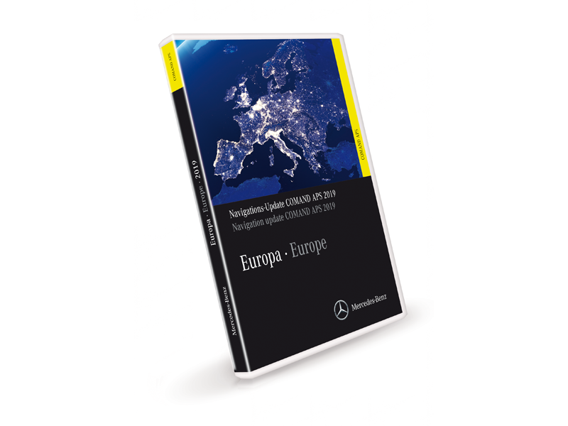
Comand APS Map NTG2.5 - 2019 Europe update DVD for A B CLC W211-E CLS SL SLK ML GL R Vans
| This is the latest Hard Disk COMAND NTG2.5 European map update released August 2019 Version "2019"
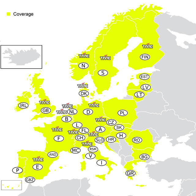
It is also the final release of maps for COMAND NTG2.5 The 2 DVDs are inserted into your Hard Disk COMAND and the system then updates the map on the hard disk. It is for the following vehicles with the Hard Disk COMAND system (which has built in bluetooth). A, B, ML, GL, R, W211-E class, CLS, SL, SLK Model Year 2009 onward (built from approx 07/2008 (CLS 03/08) CLC with Hard disk COMAND (built from approx 09/2008) MY2010 Sprinter (built from approx 08/2009) MY2011 Vito/Viano (built from approx 09/2010) - Vehicles with retrofitted COMAND NTG2.5 It will not work in North American COMAND navigation systems brought to Europe. It requires the COMAND system to have 09/29 firmware in it. Please see Q13 and Q14 on http://www.mercupgrades.com/COMAND+APS+NTG2+5+FAQ-faq-14.html#13 for details of how to check. Firmware updates can be done by www.comand.co.uk in Lightwater, Surrey, UK or at your local Mercedes dealer. 2019 (Final) Version Highlights This navigation update requires COMAND software update 09/29, available from Telematics CD 01/2010. Please contact us for details if your car is earlier that mid 2010. The two DVDs are packed with navigation data for 39 European countries, with major and minor roads, towns, villages and plenty of points of interest: Albania, Andorra, Austria, Belgium, Bosnia & Herzegovina, Bulgaria, Croatia, Czech Republic, Denmark, Estonia, Finland, France, Germany, Gibraltar, Greece, Hungary, Ireland, Italy, Latvia, Liechtenstein, Lithuania, Luxembourg, Macedonia (FYROM), Monaco, Montenegro, Netherlands, Norway, Poland, Portugal, Romania, San Marino, Serbia, Slovak Republic, Slovenia, Spain, Sweden, Switzerland, United Kingdom and Vatican City. The 2019 version covers the whole of Western Europe. The navigation data on the 2019 version covers over 10.7 million kilometres of road throughout Europe. In Eastern Europe, in addition to the Baltic states, full coverage is provided for Greece, Croatia, Poland, the Slovak Republic, Slovenia, the Czech Republic and Hungary, as well as for Bulgaria and Romania. Prime Coverage* has been significantly expanded in the following countries: • Slovenia: +3 percent • Czech Republic: +9 percent Intensive work means that the quality of the maps for the Czech Republic has been significantly improved (123,874 km Prime Coverage*, compared with 101,622 km in the previous version). The 2019 version features 90,812 towns and communities. Points of Interest (POI): Over 4.4 million key points of interest are featured on the DVDs, including filling stations, car parks, museums, restaurants and hospitals. This equates to approximately 435,000 more POIs than in the previous version. If required, the navigation system will also show the user the quickest route to 2,966 Mercedes-Benz Service Partners. Some 62,670 restaurants and 22,620 nightlife points of interest have been added to the new 2019 version. Dynamic route guidance based on the latest traffic data (TMC/RDS): Using the data from the Traffic Message Channel, the navigation system takes into account the latest motorway traffic bulletins and automatically calculates diversions. This convenient service is now available in 39 countries. Albania, Andorra, Austria, Belgium, Bosnia & Herzegovina, Bulgaria, Croatia, Czech Republic, Denmark, Estonia, Finland, France, Germany, Gibraltar, Greece, Hungary, Ireland, Italy, Latvia, Liechtenstein, Lithuania, Luxembourg, Macedonia (FYROM), Monaco, Montenegro, Netherlands, Norway, Poland, Portugal, Romania, San Marino, Serbia, Slovak Republic, Slovenia, Spain, Sweden, Switzerland, United Kingdom and Vatican City. Road network updates: Map updates include millions of changes, e.g. new roads, crossroads, bypasses, junctions and motorway slip roads and exits. One section of road may feature up to 260 attributes, such as the number of lanes or one-way streets. All of these attributes and the vast number of points of interest have to be updated constantly. In this new version, for example, over 144,362 roundabouts, 660,643 turning restrictions, 403,907 one-way streets and 5,360,699 street names have been updated. In addition, over 2,469,999 kilometres of road have been updated, including approximately 49,641 sections of motorways and dual carriageways. 2017 (V15.0) highlights The two DVDs are packed with navigation data for 39 European countries, with major and minor roads, towns, villages and plenty of points of interest: Albania, Andorra, Austria, Belgium, Bosnia & Herzegovina, Bulgaria, Croatia, Czech Republic, Denmark, Estonia, Finland, France, Germany, Gibraltar, Greece, Hungary, Ireland, Italy, Latvia, Liechtenstein, Lithuania, Luxembourg, Macedonia (FYROM), Monaco, Montenegro, Netherlands, Norway, Poland, Portugal, Romania, San Marino, Serbia, Slovak Republic, Slovenia, Spain, Sweden, Switzerland, United Kingdom and Vatican City. The 2017 version covers the whole of Western Europe. The navigation data on the 2017 version covers over 10.3 million kilometres of road throughout Europe. In Eastern Europe there is full coverage of the Baltic states, Greece, Croatia, Poland, the Slovak Republic, Slovenia, the Czech Republic, Hungary, Bulgaria and Romania. Prime Coverage* has been significantly extended in the following countries: • Bulgaria: +1 percent • Czech Republic: +6 percent • Hungary: +2 percent Intensive work means that the quality of the maps for the Czech Republic has been significantly increased (101,622 km Prime Coverage*, compared with 86,187 km in the previous version). The 2017 version features 90,812 towns and communities. Points of Interest (POI): Over 3.9 million key points of interest are featured on the DVDs, including filling stations, car parks, museums, restaurants and hospitals. There are around 100,068 more POIs here than on the previous version. If required, the navigation system will also show the user the quickest route to 2966 Mercedes-Benz service outlets. Some 11,005 restaurants and 3.079 nightlife destinations have been added to the new 2017 version. Dynamic route guidance based on the latest traffic data (TMC/RDS): Using the data from the Traffic Message Channel, the navigation system takes into account the latest motorway traffic bulletins and automatically calculates diversions. This convenient service is now available in all 39 countries. Road network updates: Map updates include millions of changes, e.g. new roads, crossroads, bypasses, junctions and motorway slip roads and exits. One section of road may feature up to 260 attributes, such as the number of lanes or one-way routing. All of these attributes and the vast number of points of interest have to be updated constantly. In this new version, for example, over 49,473 roundabouts, 128,968 turning restrictions, 165,822 one-way streets and 1,247,610 street names have been updated. In addition, over 1,331,827 kilometres of road have been updated, including approx. 16,398 sections of motorway and dual carriageway. 2016/2017 (V14.0) highlights TBA 2015/2016 (V13.0) highlights The 2015/2016 version covers the whole of Western Europe. The navigation data on the 2015/2016 version covers over 9.9 million kilometres of road throughout Europe. In Eastern Europe there is full coverage of the Baltic states, Greece, Croatia, Poland, the Slovak Republic, Slovenia, the Czech Republic, Hungary, Bulgaria and Romania. Prime Coverage* has been significantly extended in the following countries: Bulgaria +2 percent, Czech Republic +6 percent, Hungary +5 percent. The two DVDs are packed with navigation data for 34 European countries, with major and minor roads, towns, villages and plenty of points of interest: Andorra, Austria, Belgium, Bulgaria, Croatia, Czech Republic, Denmark, Estonia, Finland, France, Germany, Gibraltar, Greece, Hungary, Ireland, Italy, Latvia, Liechtenstein, Lithuania, Luxembourg, Monaco, the Netherlands, Norway, Poland, Portugal, Romania, San Marino, Slovak Republic, Slov- enia, Spain, Sweden, Switzerland, United Kingdom and Vatican City. Please ensure this is the correct set for your navigation system, opened navigation software can not be returned. Please also note that if your system is running old firmware (before 01/2010) it will need an update by the Mercedes dealer, which is often done as part of the normal servicing and should be done free of charge. The firmware updates released by Mercedes address many issues with the COMAND system behaving oddly and potentially also adds some extra functionality such as volume increase for the AUX input, and ECO mode navigation routing (alongside the normal fast, short & dynamic options). |

